Waterfalls in Japan - Waterfalls of Japan
In Japan, there are about 3000 waterfalls, and 517 waterfalls are named waterfalls. Many of these waterfalls are located in remote mountain locations such as Syomyo waterfalls located in the middle of Japanese Alps.
Japan Waterfalls are sprinkled throughout this mountainous country that sees plenty of snow and cold winter days as well as hot and rainy summer days. The rugged topography has resulted in many different kinds of waterfalls from the percolating wide curtain of Shiraito no taki as well as majestic ones like Kegon-no-taki.
Given the history and Buddhism influence, there are also waterfalls by sacred temples such as Nachi no taki and others fed by the melting snow in the Japan Alps like Shomyo daki and Hannoki no taki. And if that wasn't enough, there are places in the country where Nature has been allowed to thrive such as Daisetsuzan National Park Shiretoko National Park
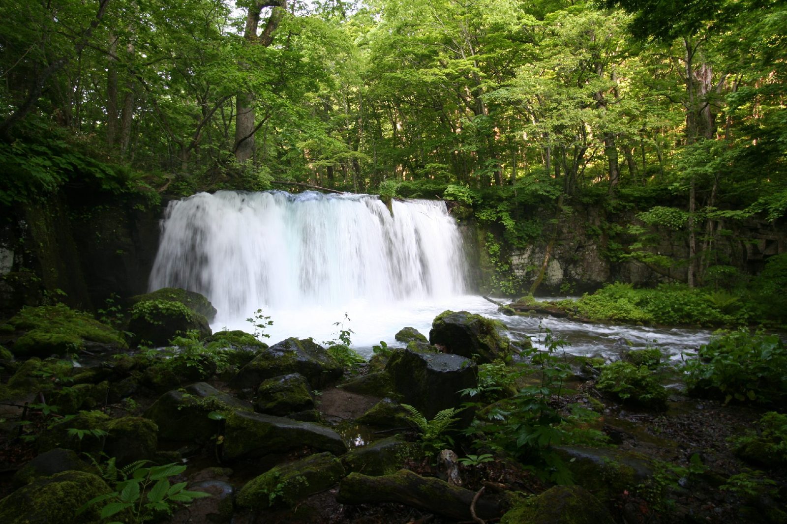 Choshi falls
Kirifuri-no-taki

Imafuku-no-taki

[Name] Imafuku-no-taki
[Place] Imafuku, Miyazu-City, Kyoto Pref.
[River] Imafuku River, the upper area of Yura River
[Style] Seven steps
[Height] 78m
Kanabiki-no-taki

[Name] Kanabiki-no-taki
[Place] Miyazu-city, Kyoto Pref.
[River] the upper area of Yura River
[Style] Diagonal(Right)
[Height] 40m

Ayu-taki

Atera-no-nana-taki

Ushi-no-taki

Choju-no-Taki (Ushio-Kannon)
 [Name] Choju-no-taki(Another Name:Choshi-no-taki)
[Place] Yamashina-Ward, Kyoto-City, Kyoto Pref.
[River] Otowa River, the upper area of Kamo River
[Style] Diagonal(Right)
[Height] 5m
Yokitogi-no-Taki (Lower parts)

Kanjo-no-Taki
Wakio-no-Taki (Sobugata-take)

 [Name] Ikaduchi-Fudo-Taki
[Place] Yamanashi-city, Yamanashi Pref.
[River] Ikaduchi River, the upper area of Fuji River
[Style] Streight
[Height] 20m
Nanatsugama-Godan-no-taki
 [Name] Nanatsugama-Godan-no-taki
[Place] Yamanashi-city, Yamanashi Pref.
[River] Nishizawa Valley, the upper area of Fuji River
[Style] Consecutive, Like the stairs
[Height] About 50m
Nishizawa-Valley(2)
 [Name] Uncertain
[Place] Yamanashi-city, Yamanashi Pref.
[River] Nishizawa Valley, the upper area of Fuji River
[Style] Streight
[Height] About 2m
Nishizawa-Valley(1)
 [Name] Uncertain
[Place] Yamanashi-city, Yamanashi Pref.
[River] Nishizawa Valley, the upper area of Fuji River
[Style] Consecutive, Like the stairs
[Height] About 5m
Oshidori-Kakushi-no-taki
 [Name] Oshidori-Kakushi-no-taki
[Place] Chino-city, Nagano Pref.
[River] Yokotani Valley, the upper area of Lake Suwa
[Style] Consecutive, Like the stairs
[Height] 15m
Bandokoro-O-Taki
 [Name] Bandokoro-O-taki
[Place] Matsumoto-city, Nagano Pref.
[River] Kooono River, the upper area of Kiso River
[Style] Streight
[Height] 40m
Zengoro-no-taki
 [Name] Zengoro-no-taki
[Place] Matsumoto-city, Nagano Pref.
[River] Kooono River, the upper area of Kiso River
[Style] Streight
[Height] 21m
Sanbon-daki
 [Name] Sanbon-daki(Left:Honsawa-no-taki, Right:Kurosawa-no-taki)
[Place] Matsumoto-city, Nagano Pref.
[River] Kooono River, the upper area of Kiso River
[Style] Streight(Left), Diagonal(Right)
[Height] 40m(Both)
 [Name] Karasawa-no-taki
[Place] Kiso-cho, Nagano Pref.
[River] Nishihora River, the upper area of Kiso River
[Style] Consecutive, Like the stairs
[Height] 50m
Ushi-ga-taki
 [Name] Ushi-ga-taki
[Place] Nagiso-cho, Nagano Pref.
[River] Kakizore Valley, the upper area of Kiso River
[Style] Streight
[Height] 18m
Me-daki
 [Name] Me-daki
[Place] Nagiso-cho, Nagano Pref.
[River] Odaru River, the upper area of Kiso River
[Style] Streight
[Height] 10m
O-daki
 [Name] O-daki
[Place] Nagiso-cho, Nagano Pref.
[River] Odaru River, the upper area of Kiso River
[Style] Streight
[Height] 10m
O-taki
 [Name] O-taki
[Place] Katsuyama-city, Fukui Pref.
[River] Takinami River, the upper area of Kuzuryu River
[Style] Consecutive, Like the stairs
[Height] 20m
Fudo-taki
 [Name] Fudo-taki
[Place] Katsuyama-city, Fukui Pref.
[River] Takinami River, the upper area of Kuzuryu River
[Style] Consecutive, Like the stairs
[Height] 10m
Nodo-no-taki
 [Name] Nodo-no-taki
[Place] Katsuyama-city, Fukui Pref.
[River] Megami River, the upper area of Kuzuryu River
[Style] Consecutive, Like the stairs
[Height] 35m
Sakosaga-no-taki
 [Name] Sakosaga-no-taki
[Place] O'no-city, Fukui Pref.
[River] hinokitani River, the upper area of Kuzuryu River
[Style] Streight
[Height] 22m
Hotokegozen-no-taki
 [Name] Hotokegozen-no-taki
[Place] Ono-city, Fukui Pref.
[River] Kuzuryu River, flowing from Mt.Arashimadake
[Style] Consecutive, Like the stairs
[Height] 70m
Ben-ga-taki
 [Name] Ben-ga-taki
[Place] Katsuyama-city, Fukui Pref.
[River] Megami River, the upper area of Kuzuryu River
[Style] Streight
[Height] 30m
Ryuo-no-Taki


 [Name] Funao-taki
[Place] Yoshioka-cho, Gunma Pref.
[River] Takizawa River, the upper area of Tone River
[Style] Streight
[Height] 50m
[Place] Koriyama-city, Fukushima Pref.
[River] Ishimushiro River
[Style] Two steps
[Height] 48m
Tatsusawa-fudo-taki
[Place] Inawashiro-cho, Fukushima-Pref.
[River] Tatsusawa River, the upper area of Inawashiro Lake
[Style] Streight
[Height] 10m
Namegawa-Otaki
 [Name] Namegawa-Otaki
[Place] Namegawa Hot Spring, Yonezawa-city, Yamagata-Pref.
[River] Otakigawa River, the upper area of Mogami River
[Style] Diagonal
[Height] 80m
Futakuchi Valley
 [Name] Nothing
[Place] Taihaku-ku, Sendai-city, Miyagi-Pref.
[River] Futakuchi Valley, the upper area of Natori River
[Style] Consecutive, Like the stairs
[Height] Uncertain
Ane-taki
 [Name] Anetaki
[Place] Taihaku-ku, Sendai-city, Miyagi-Pref.
[River] Futakuchi Valley, the upper area of Natori River
[Style] Streight
[Height] 16m
"Ane" means "elder sister" in Japan. At the next of this waterfalls, "Imouto"taki flows. "Imouto" mean 'younger sister'.
The stroll road leads sideward of the direction board.Because Uppermost partof this watarfalls goes out of "Anetaki" up soon though "Imoutotaki" can be seen between trees, the whole content of the waterfall cannot be seen. You should aim at Suspension Bridge from the downstream by about 200m, go along in addition in the rock, and go out in front of the waterfall. "Imoutotaki" can be seen at the same time.

 [Name] Homei-Shiju-Hachi-taki
[Place] Aoba-ku, Sendai-city, Miyagi-Pref.
[River] Hirose River
[Style] Consecutive, Like the stairs
[Height] 30m
Sekiyama-O-taki
 [Name] Sekiyama-Otaki
[Place] Sekiyama, Higashine-city, Yamagata Pref.
[River] Midare River, the upper area of Mogami River
[Style] Diagonal
[Height] 10m
[Comment]
Tamugimata-no-taki
 [Name] Tamugimata-no-taki
[Place] Tsuruoka-city, Yamagata-Pref.
[River] Tamugimata River
[Style] Streight
[Height] 40m
Shiraito-no-Taki


 [Name] Kaminari-taki
[Place] Takayama-vlg., Nagano Pref.
[River] Matsukawa Valley, the upper area of Shinano River
[Style] Streight
[Height] 30m
Uguisu-Taki

Senpiro falls
 Joren falls
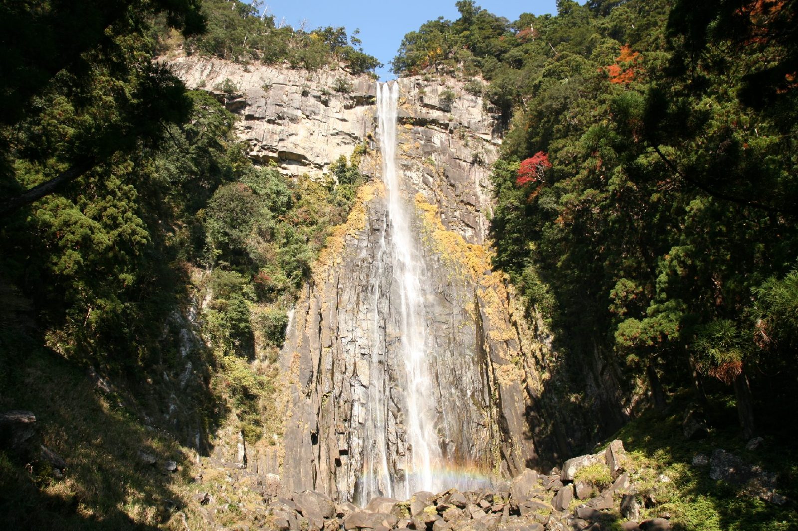 Nachi falls
 Tsugane falls
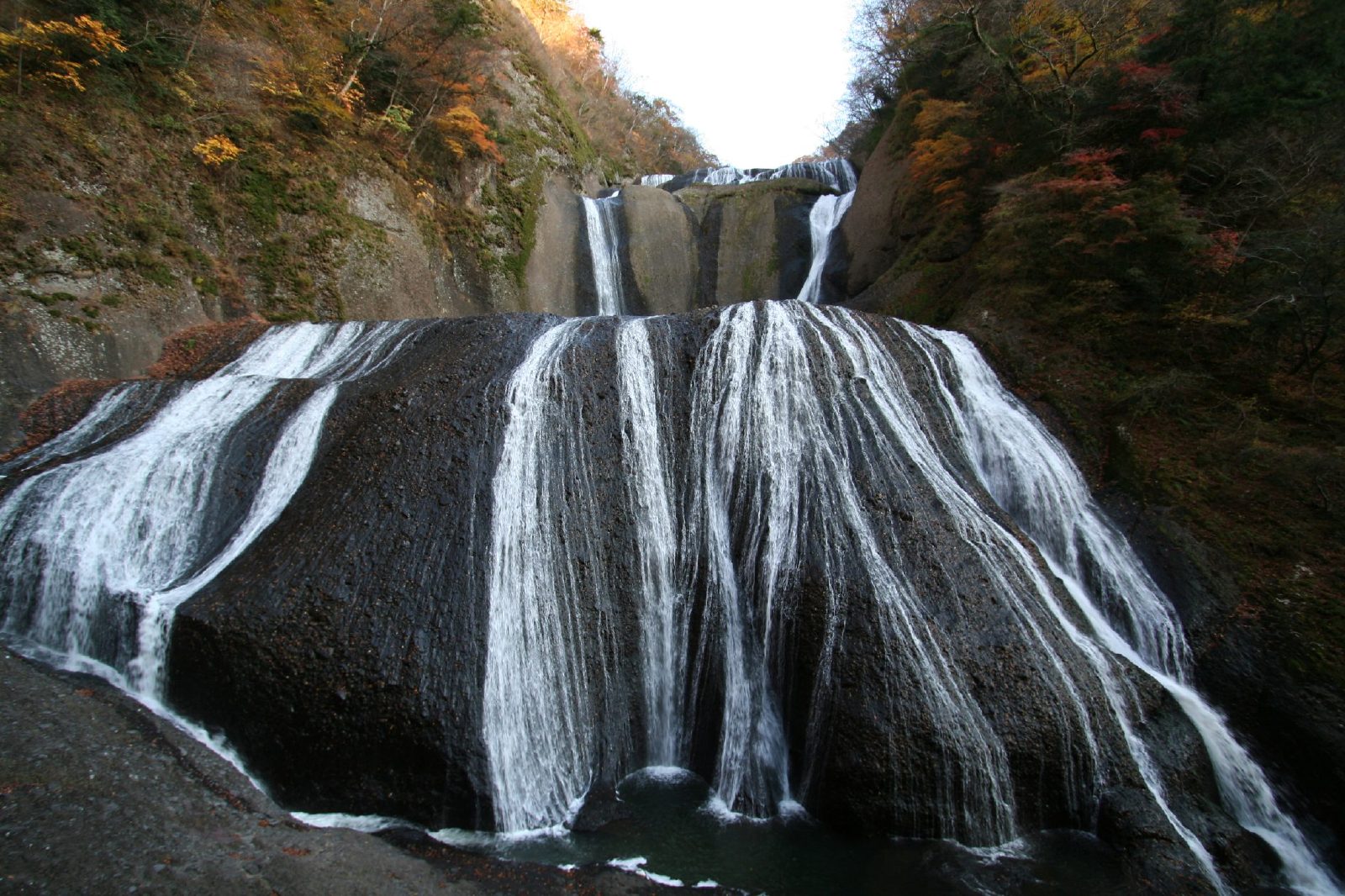 Fukuroda falls
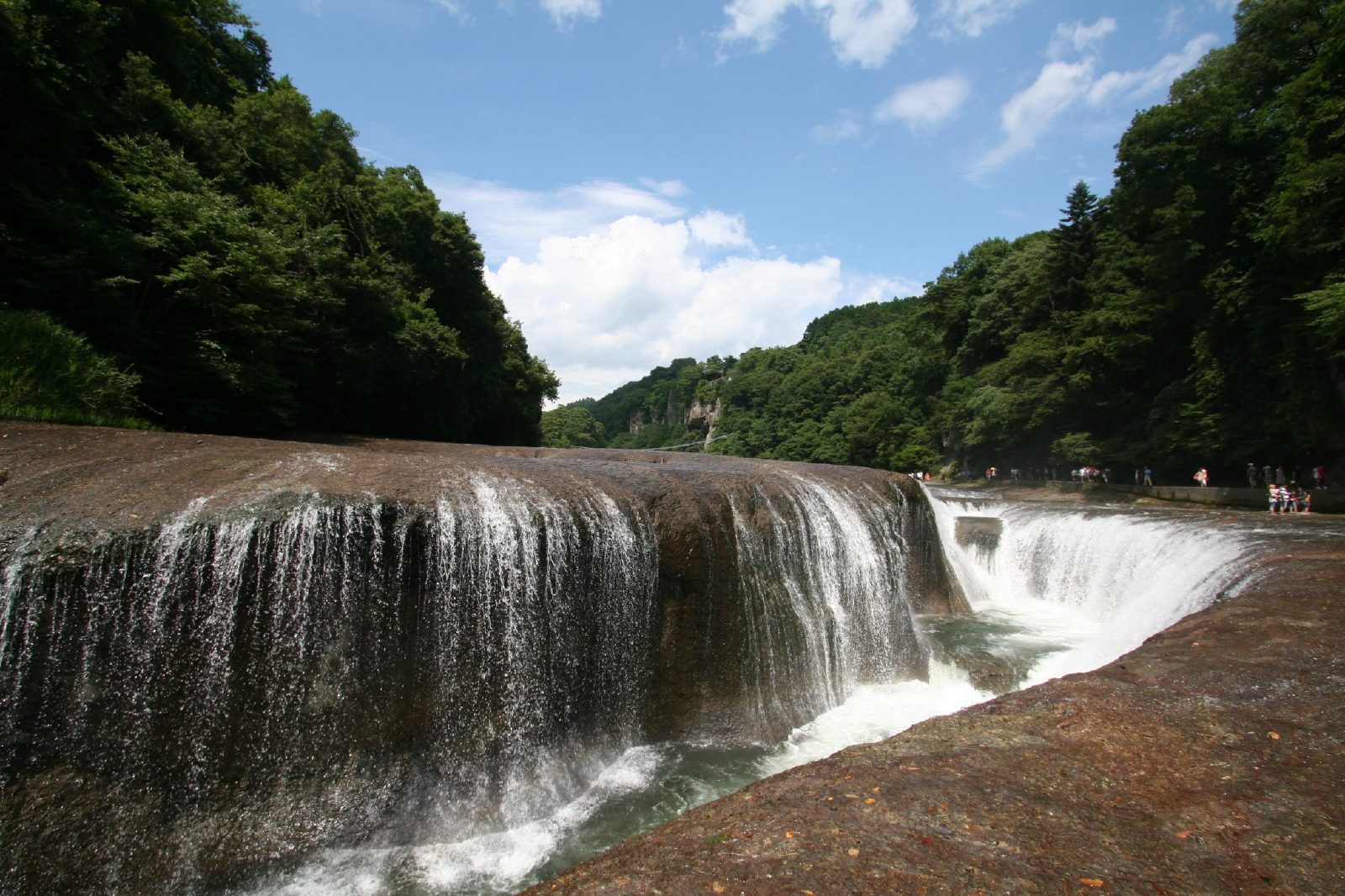 Fukiware falls
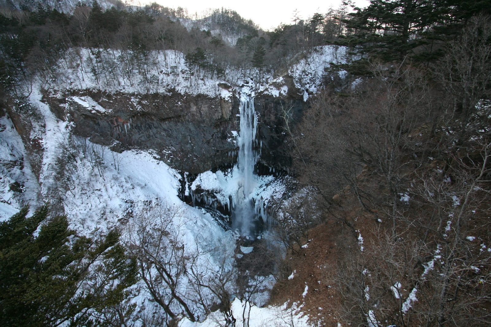 Kegon falls
 Oshinkoshin Falls
 Jinba falls
 Anmon falls
 Hirayu falls
 Hossawa falls
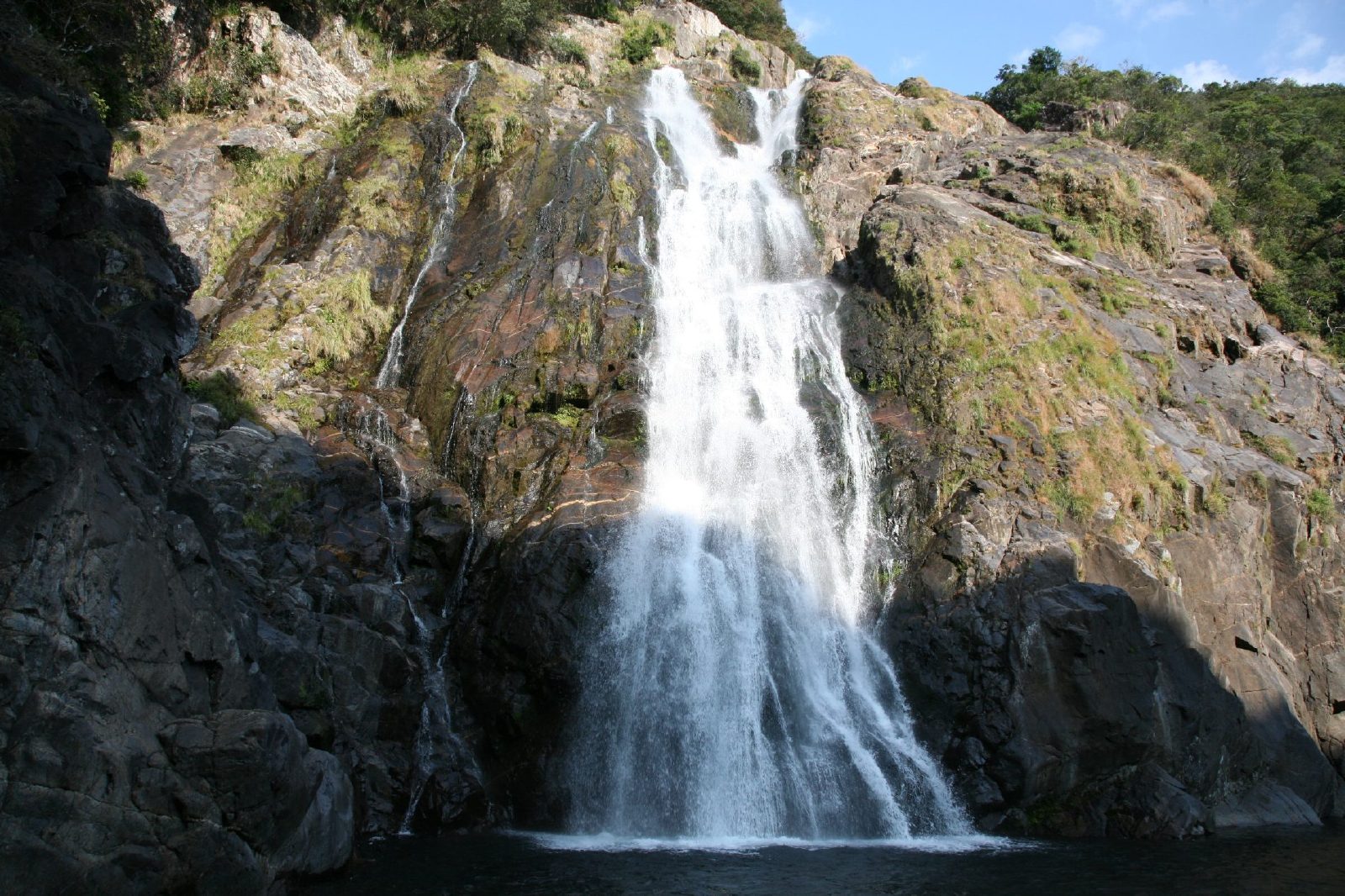 Oko falls Choshi falls
Tags: waterfalls in Japan, waterfalls of Japan, List of waterfalls in Japan, Waterfalls, waterfall in Japan, waterfalls Japan, Falls in Japan, Japan Falls, Tallest Fall in Japan, Widest Water fall Japan, The widest waterfall in Japan, Photos of Japan Water falls, Japan waterfalls Photos, Top waterfalls in Japan
No comments:
Post a Comment